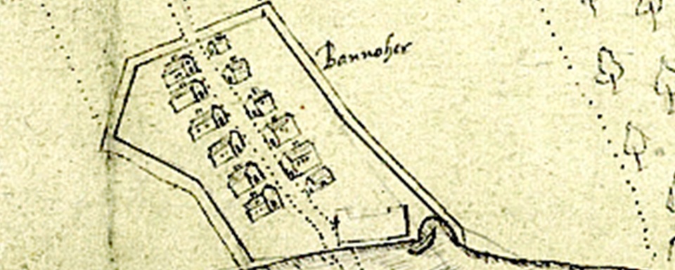
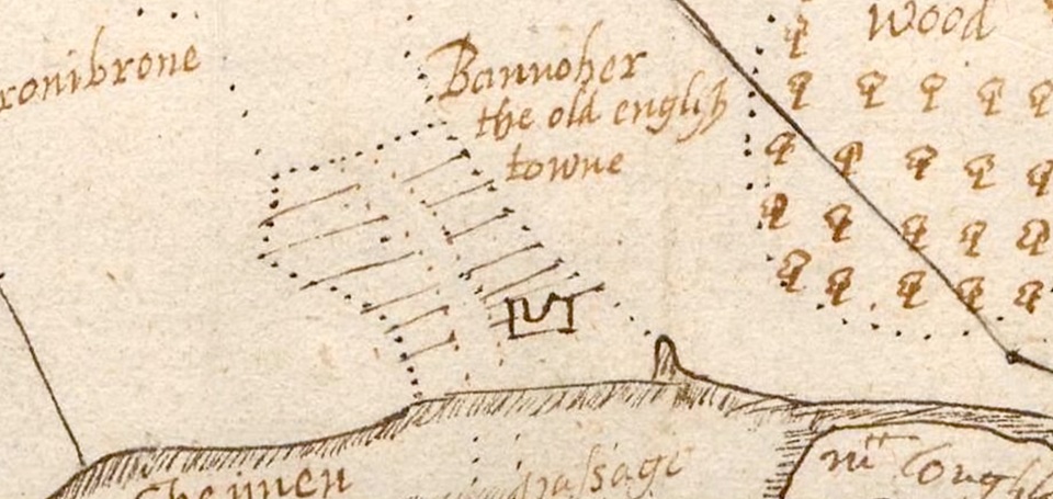
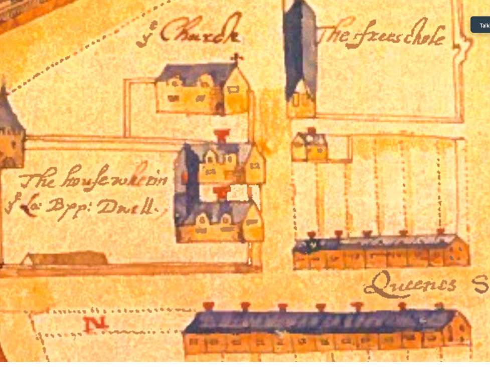
“Bannoher the old english towne”
Three 16th / 17th century maps in the National Archives in London represent Banagher on the Shannon by this title.
To say that Banagher was an ‘old English town’ implies that the town and the area surrounding Banagher was for some time developed and administered by the ‘English’. Such a town would be described in historical terms as being ‘Anglo- Norman’. The Anglo-Norman (or English) invasion of Ireland began in 1169 and extensive areas of Ireland were overtaken, controlled and administered until the 1300s.

Map References
The maps in question are from the National Archives, London and are referenced:
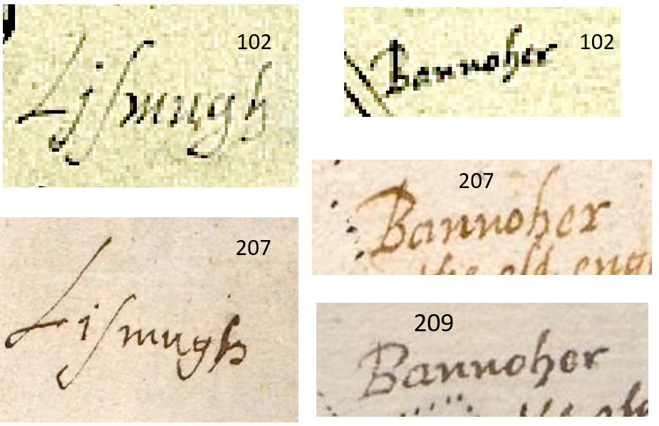
MPF 1/102 Date indication 1533-1603 (henceforth ‘102’). MPF 268 which contains 26 maps of Banagher and other areas in Offaly. De Renzy Ms SP46/91 page 207 Date indication 1630 (henceforth ‘207’). De Renzy Ms SP46/91 page 209 Date indication 1630 (henceforth ‘209’). Maps 207 and 209 are in very good condition. Map 102 has been affected by exposure. Reference is also made to and extracts used from several documents from De Rezny Ms SP46 90-93 which contain about 1000 pages.
Many of these are by Matthew De Renzy himself relating to his Irish business affairs and in particular to his properties in West Offaly. Brian Mac Cuarta has transcribed perhaps 40% of these documents. The rest have, regrettably, never been interpreted or published and await further scholarly attention. Reference is also made to De Renzy maps MPF 268 which contains 26 maps of Banagher and other areas in Offaly. Matthew De Renzy & William Parsons.
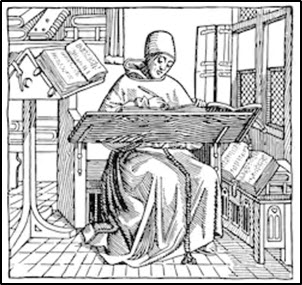
Matthew De Renzy came to Ireland about 1606, lived in Clonony Castle until 1619 and in Dublin until his death in 1634. He was truly an extraordinary character and perhaps above all he is renowned for the fact that on his arrival in Ireland he spent years learning Irish in Thomond with the renowned Mac Bruaideadha family.
The National Archives catalogue states that maps 207 and 209 are the same but not identical.
There is no documentary or archaeological evidence for an Anglo-Norman town in Banagher. That a town containing twelve large individual houses could have survived in some fashion from the thirteenth to the seventeenth century without leaving some records is most unlikely.
SUMMARY
It will be shown that, regardless of the catalogue date difference, the handwriting on maps 102, 207 and 209 is by the same person and also that the three maps are based on the same original map.
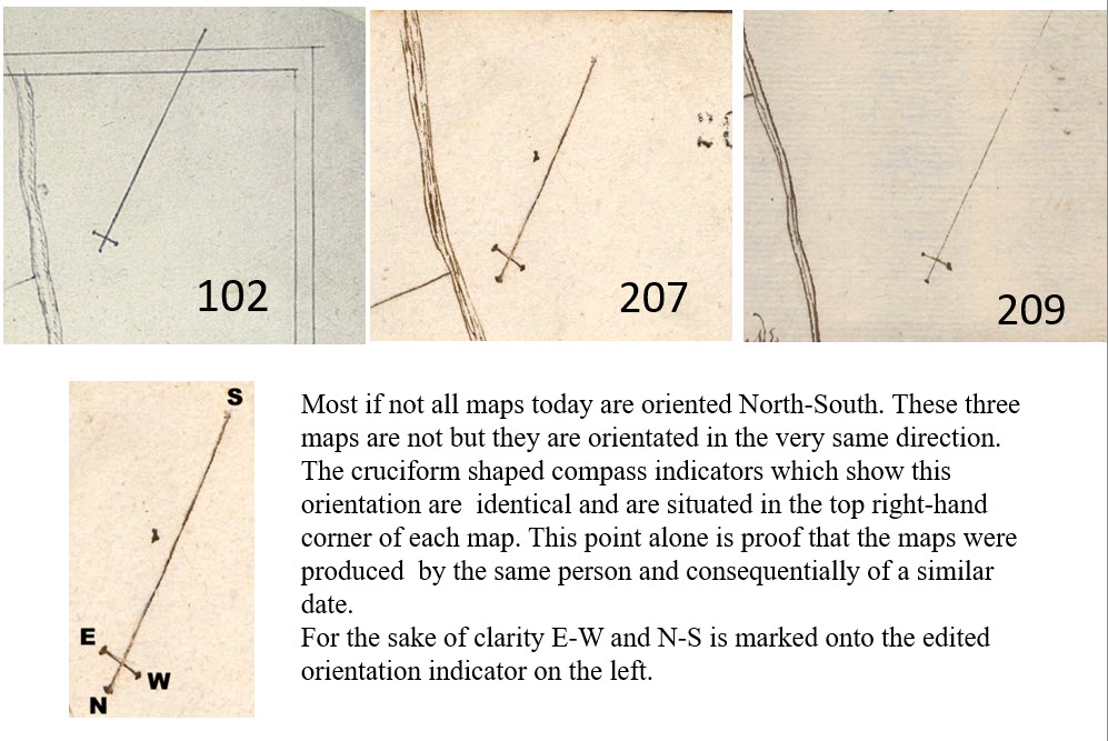
None of the maps are oriented N-S as is typical today. However, the orientation is the same on the three maps and the compass indicators are identical.
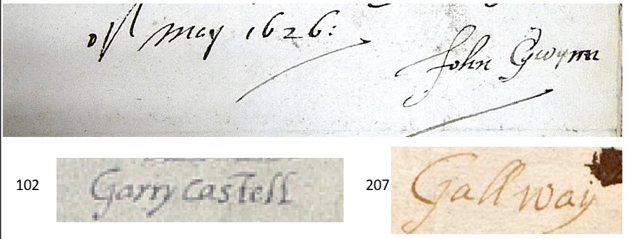
It will also be shown that the three maps were by a cartographer or surveyor / mapmaker called John Gwynn (Gwin).This is the same John Gwynn who spent years ‘working’ for De Renzy in the Banagher and West Offaly area during the period 1625 to 1633.
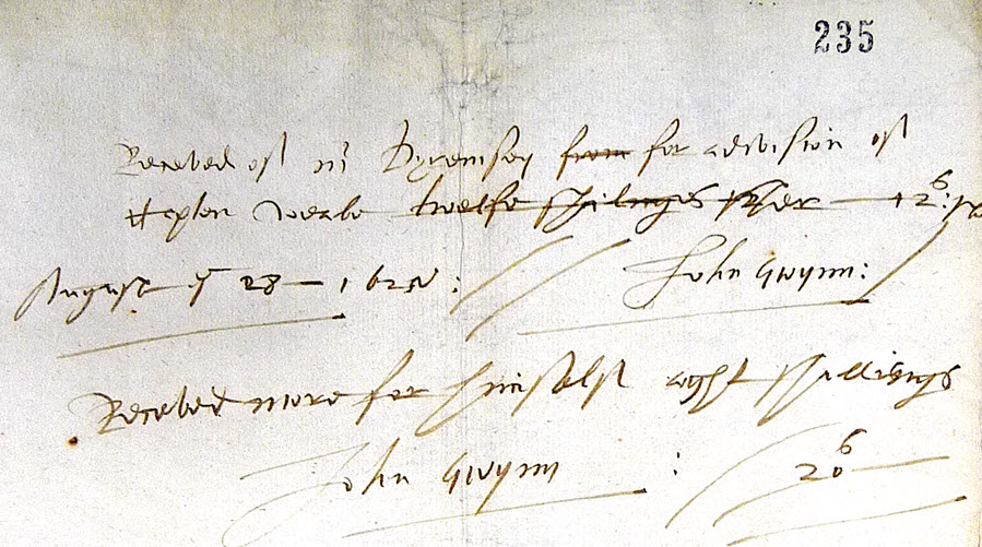
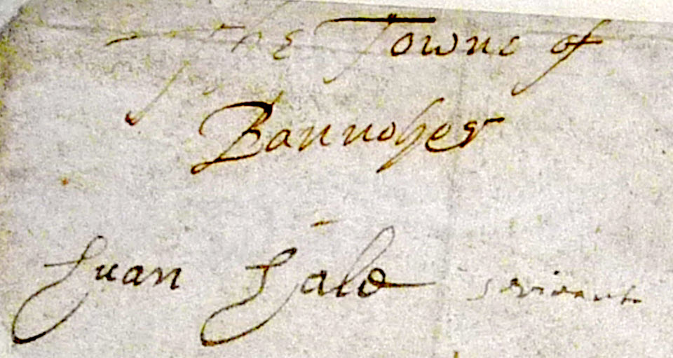
A note on the back of map 207 states:
‘The towne of Bannoher’
‘Huan Halo scrivit’
It will be shown that Huan Halo was in fact John Gwynn and that the purpose of this note was deception.
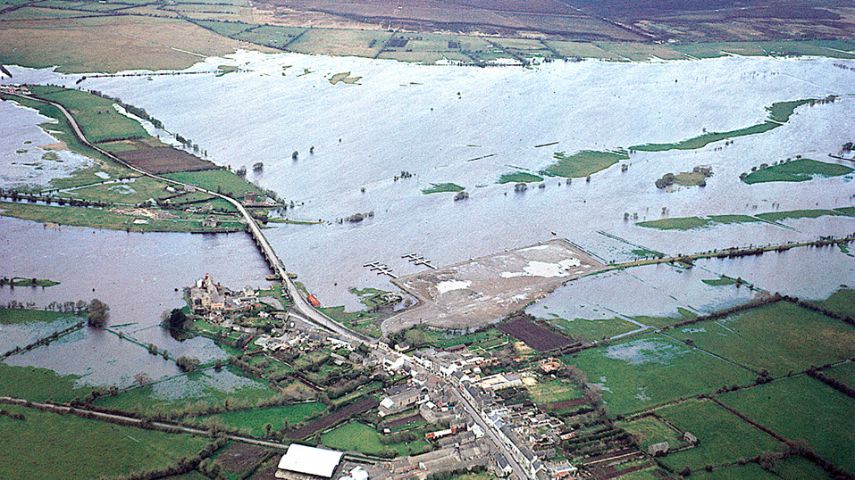
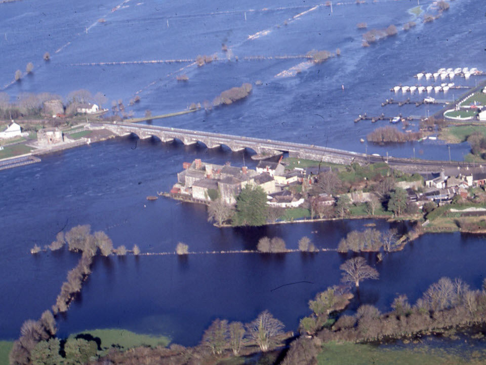
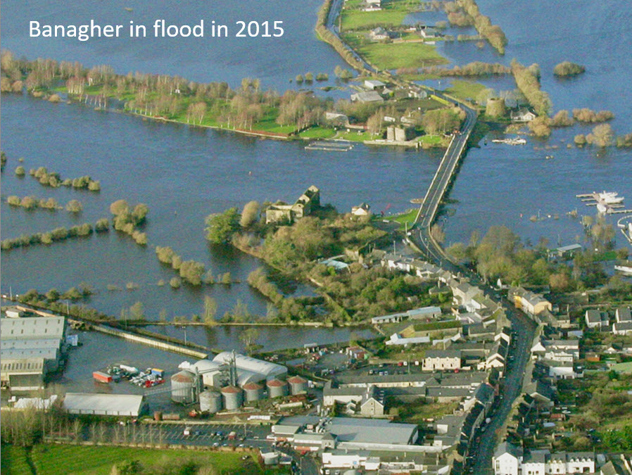
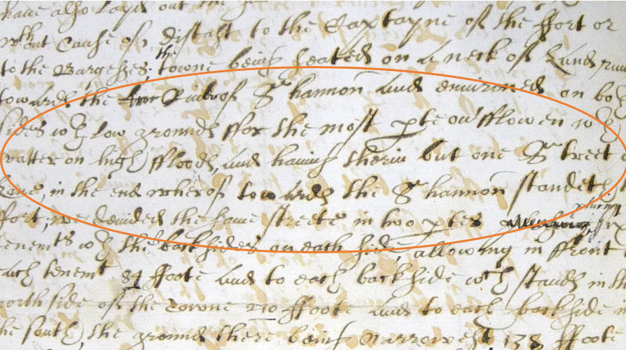
Aerial photos of Banagher in flood show that ‘The old English towne of Bannoher’ would have been on a flood plain. De Renzy’s letters record that this area was ‘for the most part overflowen with water on high floods’. The Anglo-Normans would not have built on a flood plain.
Archives date for 207 and 209 is c.1630
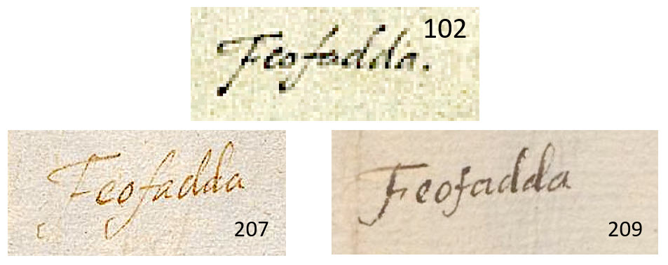
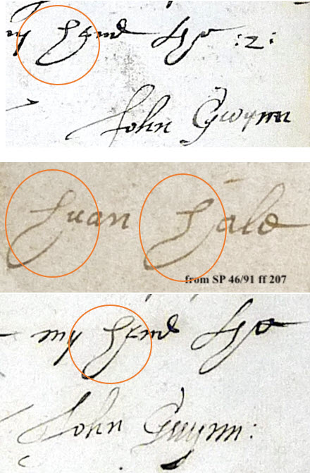
These are extracts from each of the three maps showing examples of handwriting. It is obvious that the writing on the three maps is in the same hand.
ALL FROM THE SAME BASE MAP
Physically copying (tracing) one map from another was common practice until relatively recent times. A little examination shows that this is what happened with maps 102, 207 and 209. By using ‘Powerpoint’ (or similar) and by varying ‘transparency’ it is possible to overlay and accurately check one map against another. This check proves clearly that the three are off the same original or base map.
The maps are all to the same scale (40 perch to an inch -see extract from 102 below.
‘By a scale of 40 (perch) – to a inch’
WHO WAS THE CARTOGRAPHER / MAPMAKER?
John Gwinn (Gwynn) was one of at least six surveyors including the renowned Thomas Raven who worked around Banagher and across Offaly from 1625 to 1633.
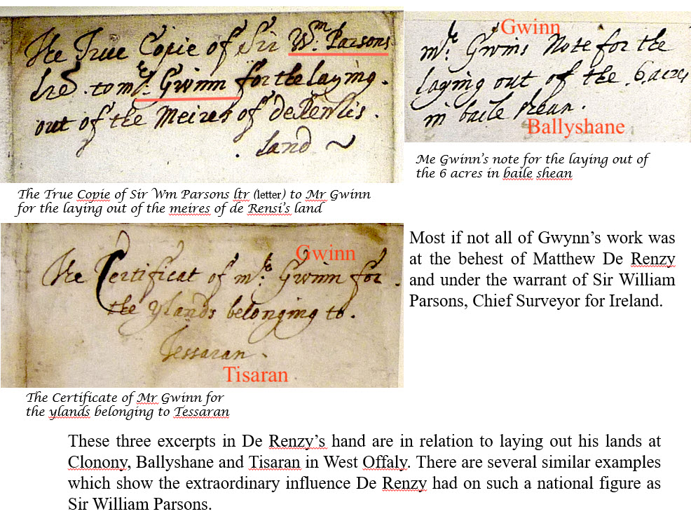
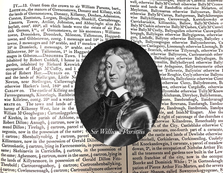
Not only does Gwynn’s name appear on several maps of West Offaly but letters between William Parsons, Surveyor-General from 1602 to 1641, and Mathew De Renzy have multiple references to Gwynn. These are mainly warrants from Parsons to Gwinn to survey and layout lands in and around Banagher, and in particular De Renzy’s own lands. Fortunately, most of the correspondence is dated and covers the period 1625-33.
Apart from the De Renzy Ms and maps no other reference to Gwynn’s work in Ireland has come to light. The other surveyors were Raven, Jobson, Stubbs, Woodehouse and Moris. It is remarkable that six eminent surveyors were involved in surveying across Offaly over a period of seven years or more. Much of the land surveyed was bog which would have been a very difficult challenge. It would appear that all of this work was for the benefit of Matthew De Renzy with the repeated approval of Sir William Parsons. At least some of the maps were for the discovery of ‘defective titles’ which was Parsons area of expertise.
In 1631 Thomas Raven was surveying on Lemanaghan bog. He may have been finding this tough going as his report includes this piece.. ‘For my legs doth put me through the most intolerable pain…’
Thomas Raven’s fabulous 1622 map of London Derry is on the next page.
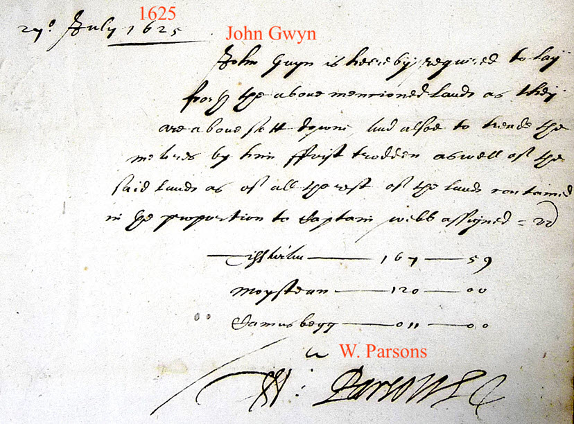
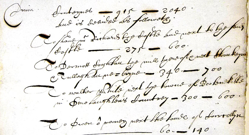
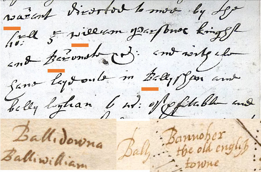
This warrant relates to laying out lands in Druin known today as Lemanaghan. These lands are listed on the next page. The date of August 1625 is very significant as will be shown.
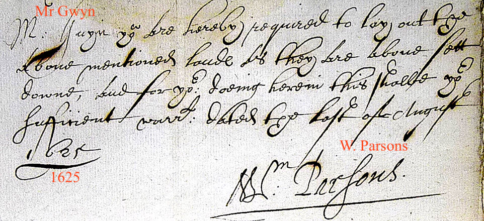
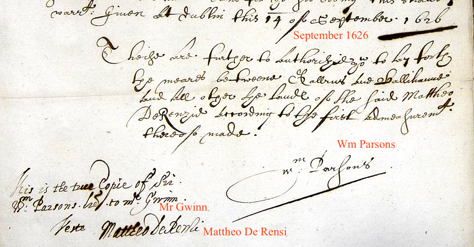
The writing on the bottom left is by De Renzy himself, spelled ‘Rensi’ in this instance.
GWYNN SURVEYED BANAGHER
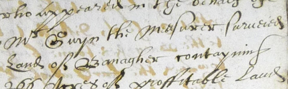
This extract from a very important document (yet to be published) dated October 1628 relates to a dispute between the burgessmen of Banagher Corporation and their sovereign, Sir Arthur Blundell. Part of the letter describes how the layout of the new town was constrained by floods.
“Mr Gwyn the measurer surveied the whole towne and land of Banagher containing 266 acres.”
‘John Gwynn’ was the spelling used where he signed his name. Gwyn, Gwin, and Gwinn also appear.

This note is also by De Renzy himself.


The crossing point on the Shannon at Banagher came into existence because of the esker at that location . It provides just a ‘narrow neck of land’ that is flood free. Image is from the late 1960s.
INTRIGUE!! AND DECEPTION !!!!
This note is on the back of map ‘207’. It is almost certainly intended to deceive by suggesting the map was by someone called Huan Halo. ie Huan Halo scrivit or drawn by Huan Halo. (The first letter is ‘h’ although it resembles ‘g’) Note Gwynn’s characteristic capital ‘B’ in Bannoher.
It is surely ironic and ‘Bangs Banagher’ that the most conclusive piece of evidence that John Gwynn made the maps and was Huan Halo, is provided by the ‘Huan Halo’ signature itself!!
ANOTHER REMARKABLE RESEMBLANCE!
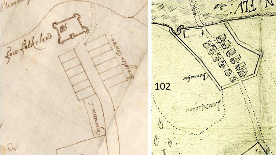
The Corporation town of Banagher as laid out by John Gwynn in 1628 has 2 rows of 6 large plots and so has ‘Bannoher the old english towne’ !!
‘..whereby they might not know in time from whence they came.‘
De Renzy engaged in a written campaign to present an alternative history to that recorded by the Irish bards and chroniclers. The essence of his version was that Ireland was always English. On numerous occasions he urges that these Gaelic professional historians be eliminated so that the native Irish would not know their past. De Renzy writing to Lord Deputy Chichester from Clonony Castle, July 1615, states regarding the Irish Bards and Chroniclers: fit it were that those were drowned whereby they might not know in time from whence they came.
Not only should they be eliminated but also that they be compelled streightley (strictly) leave their profession, and to deliver up their books.’
‘For as long as that is currant amongst them they will ever be shrewder and more suttler then the Englisch that comes out of England; and espetially such as can Englisch for their owne mother’s tongue, brings them to be naturally wittie and craftie, which ours doth not.’
But the maine point lyeth that wee suppress their heads and their language that they maie not keepe any remembraunce from whence they cam’.
The creation of ‘Bannoher the old English towne’ was in keeping with the version of history that he zealously promoted. And amazingly, in so far as the map is concerned, he has been successful for 400 years!
CONCLUSIONS
It has been shown that 102, 207 and 209 are by the same person and basically the same map. ‘102’ is catalogued separately from the De Renzy Ms which caused it to be dated (1533-1603) rather than (c1630) and this as well as the elaborate detail in which the houses are shown has promoted the idea of a charming romantic Anglo-Norman town at Banagher.
There is no doubt that John Gwynn was the map maker and invented Huan Halo for the purpose of De Renzy’s deception.
The Anglo-Normans would not have built in a flood plain.
Gwynn laid out the Corporation town of Banagher with it’s 12 big plots for the Burgessmen. This influenced him to lay out the fictitious ‘Bannoher the olde english town’ in a similar arrangement.
The houses on map ‘102’ would surely have to be 13th century. The level of detail in which they are shown must be proof on its own that the map was an invention.
It does not make historic sense that such a significant settlement stood for 400 years, c.1230-1630, without any documentary record or archaeological remains.
However, the fact that his creation ‘Bannoher the old english towne’, would continue to have believers after 400 years would surely have given him even greater satisfaction.
Continuing the recognition of these maps as being authentic sustains the deception and only serves to accomplish his overriding ambition about the Irish… that they would not know in time from whence they came. We owe it to posterity to bring this deception to an end.
POSTCRIPT
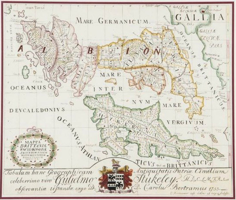
Banagher also features in Sir Charles Coote’s musings on Charles Bertram’s famous 1755 fake map and manuscript on Roman Britain.
Fakes forgeries and the society of Antiquaries – Richard of Cirencester 1757
The description of Britain translated from Richard of Cirencester
Cootes Statistical 1801 survey of the Kings County for Banagher see page 117
This map (below) was not finally identified as a fraud until 1867 by B.B. Woodward who wrote in his conclusion ‘…archaeologists ought, with especial care, to avoid the easiness and the confusedness of their predecessors, and vindicate for their inquiries and their conclusions alike, the authority which belongs to historical research alone.’